Our vacation to Savannah and Charleston

A few weeks ago we went on a week-long vacation to Savannah, Georgia, and Charleston, South Carolina.

For the last ten years, give or take, I have had a carefully curated travel bucket list. This trip was exciting for me, because this is one of the original trips that went on that list.

This week was all about Civil War history for me. It was amazing to finally be in places that I have read about for years.

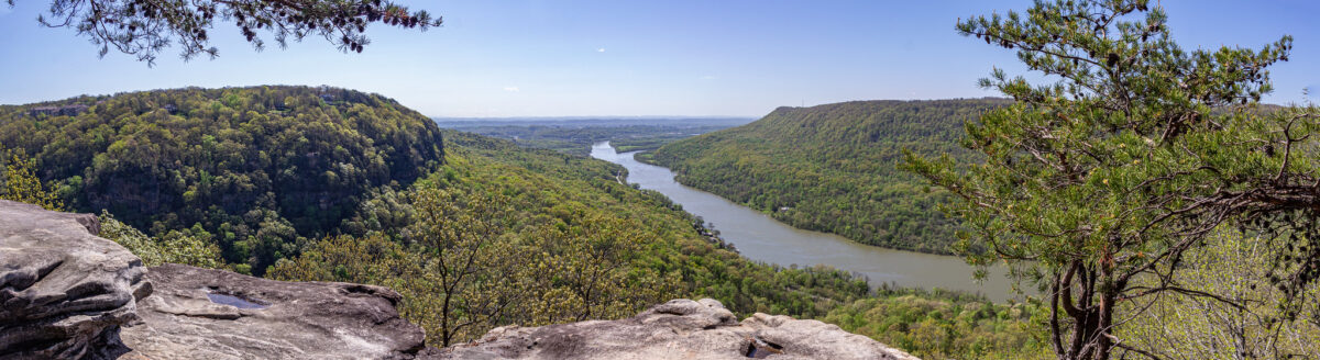
Our first three and a half days were in Savannah. Some of the things we did there included exploring all of the squares, Bonaventure Cemetery, Wormsloe Historic Site, a riverboat cruise on the Georgia Queen, and General Sherman’s headquarters.

Savannah_27
Bonaventure Cemetery was beautifully eerie. The Spanish moss was a lovely backdrop.
Savannah_37
Savannah has 22 squares, each a few blocks apart. The squares were designed to give residents a green space to enjoy. Some squares are smaller, but some feature fountains or monuments.
Savannah_63
The Georgia Queen docked on the Savannah River.
Savannah_143
The Green-Meldrim House, General Sherman’s headquarters while the Union Army was in Savannah. This was the end location of Sherman’s March to the Sea.
Savannah_179
The Savannah River is a major waterway. We saw a lot of large container ships.
Savannah_232
At the fountain at Forsyth Park, the largest of Savannah’s squares.
Savannah_430
The 1.5 mile long Avenue of Oaks at Wormsloe Historic Site.

My favorite thing we did in the Savannah area was Fort McAllister. On Dec. 13, 1864, General William B. Hazen (no relation, we think, but still neat) led an attack on Fort McAllister, on the Ogeechee River, south of Savannah. This was vital, in order to gain Union control of the waterway. Hazen’s division had the element of surprise, and the battle lasted 15 minutes. With the fort in union control, the union army was able to march into Savannah, and have the supplies that they needed.

We were able to visit Fort McAllister on Dec. 13, to the day, which was a nice touch. We were the only two people at the fort! We couldn’t believe that.

Savannah_327
With a sign explaining Hazen’s attack on Fort McAllister.

Savannah_329
A Hazen points to Hazen on the sign.
Savannah_336
Enjoying Fort McAllister all to ourselves.

A lot of this trip, in both cities, was devoted to walking the different streets, and taking in the old, historical buildings.

Savannah_235
Savannah_108

We spent one half day exploring Tybee Island, which is known as Savannah’s beach. We both enjoyed Tybee Island, and said we would enjoy a full beach vacation here. We spent some time on the beach, and enjoyed watching a group of surfers.

Savannah_373
Savannah_390
Savannah_391
Savannah_397

After the first half of our trip in Savannah, we drove two hours to Charleston.

Some of what we did in Charleston included shopping at the historic City Market, seeing the Pineapple Fountain, Rainbow Row, Boone Hall Plantation, and the Angel Oak tree.

Charleston_7
Charleston City Market, established in the 1790s.
Charleston_21
At the Pineapple Fountain, located at the waterfront.
Charleston_152
The Angel Oak tree is estimated to be 400 years old!
Charleston_243
Rainbow Row.
Charleston_297
Boone Hall Plantation.

The highlight in Charleston for me was visiting Fort Sumter. The first shots of the Civil War were fired upon Fort Sumter on April 12, 1861. I am a Civil War history buff, so it felt good to finally get there!

Charleston_90
Approaching Fort Sumter on the ferry.
Charleston_110
An artillery shell embedded in the wall.
Charleston_118
The view from on top the fort, with our ferry in the background.
Charleston_125
Cannons on display at the fort.
Charleston_136
The first flag that the Confederates raised after Fort Sumter fell.
Charleston_99
Another view inside the fort.
Charleston_122
I was a Civil War reenactor for eight years, trained on artillery. I often was in charge of placing the primer, in which part of my job was to “tend the vent.” This is what I am doing in this picture, putting my thumb over the vent to seal off air. Whenever we come across a cannon, I have to take a picture like this!

Another thing we really enjoyed in the Charleston area was visiting the Charleston Tea Garden, which is the only place in North America were tea is grown. We took a trolley tour, and we learned a lot of facts about tea, such as the growing season is from April to October. Tea grows in bushes, and during harvest time, a special cutting machine trims off the tops of the bushes to get the leaves.

The gift shop was a tea lover’s paradise, with many free samples of tea to taste. We bought loose leaf tea both for ourselves, and for my parents as Christmas gifts.

Charleston_187
Charleston_190

In addition, like in Savannah, we enjoyed seeing all of the historic homes.

Charleston_208
Charleston_47

Our favorite thing about Charleston was something that we stumbled upon, something that we had never planned to do. Our hotel was across the harbor in Mount Pleasant. We were back at the hotel just before dinner, and we were looking for something to do that evening. Thanks to a Google Maps search, we found Shem Creek, just a few miles south.

We walked along the Shem Creek Boardwalk, a series of paths that went over the marsh and followed the waterway. There, we watched all kinds of birds, fishing boats going in and out, kayakers, and even a few dolphins! We watched the sunset. We enjoyed this so much that we came back the for a second night.

Charleston_273
Charleston_282
Charleston_274
Charleston_424

We spent our last afternoon at Sullivan’s Island Beach. We had the perfect weather on our trip with temperatures in the 60s-70s, so a beach afternoon in December wasn’t too crazy!

Charleston_384

While at Sullivan’s Island, we explored Fort Moulrie. This was another unexpected bonus, as we did not plan to do this.

Charleston_409
Charleston_416
An unexpected highlight for Derek was getting to lock up the powder magazine at Fort Moultrie with the original key!

On our way home, we broke up the drive by stopping to see a few things in Atlanta. We visited the MLK Jr. National Historical Park, which included Ebenezer Church, where he was co-pastor, his birth site, and the graves of himself and Coretta Scott King. Everything was closed because of COVID-19, but at least we got to see the outside of these historic places.

Atlanta16
The grave sites.
Atlanta23
The birth site.

We had a great time on this vacation. We did everything that we wanted to do and then some. Now we are back home with all of the pictures, video and memories, and we’re looking forward to the next trip!

Three Civil War sites in one morning

On Thanksgiving morning, we visited three Civil War sites, one for each battle.

The Battles of Chattanooga lasted over three days, from Nov. 23-25. The first was the Battle of Orchard Knob. The second was the Battle of Lookout Mountain and the third was the Battle of Missionary Ridge.

Our first stop was Cravens House on Lookout Mountain. We have already been here once, starting a hike from this point. You can read more about it and see more pictures here.

The Battle of Lookout Mountain included fighting around the Cravens House. The house was used as headquarters for both the Confederates and Union.  

Then we went to Orchard Knob, which is a grassy hill that spans for two blocks, and is filled with monuments. On Nov. 25, General Grant stood on top of Orchard Knob, and watched the Battle of Missionary Ridge unfold. There is a great vantage point of the city from Orchard Knob.

I enjoyed this spot in particular, because by seeing Missionary Ridge, you can picture and understand what it was like for General Grant.

Our last spot was the Sherman Reservation, at the very north end of Missionary Ridge. This area preserves the spot where Sherman’s troops fought against Confederates at Tunnel Hill. The Sherman Reservation features a small walking trail through a wooded area to get to a grassy area with monuments and plaques.

There are still so many sites to see, particularly along Lookout Mountain, with more trails to hike, and more reservations along the length of Missionary Ridge. I am glad that we made the time to see some new sites, and tick some boxes off.

Civil War Sites0
The view from the Cravens House.
Civil War Sites14
Civil War Sites17
Orchard Knob.
Civil War Sites19
Lookout Mountain as seen from Orchard Knob.
Civil War Sites31
Civil War Sites30
Missionary Ridge as viewed from Orchard Knob.
Civil War Sites35
The front entrance of Sherman Reservation. It’s a short hike from here to get to the monuments.
Civil War Sites37
Civil War Sites39

Browns Ferry Federal Road Trail

I am counting down the days until cooler weather arrives, because I am looking forward to resuming hiking.

I have been Googling Chattanooga area hikes, and I am curating quite the list. It has been frustrating to discover all of these wonderful places, and know that it’s just not the best time to attempt a 3 mile hike.

This morning I was looking at hikes on Moccasin Bend. I found the Browns Ferry Federal Road Trail, and I got so excited about it, that we had to go right NOW.

The weather has been cooler all weekend because it has been raining on and off, and it was mostly cloudy, keeping the sun at bay. I had found the trail early in the morning, about 9:30, and convinced Derek to go. We were at the trail parking lot by 10 a.m.

The reason why I just couldn’t wait a few weeks is because the trail is a historic one, and I love history.

Browns Ferry Federal Road was a road in use since the early 1800s. A “trace” of the road on Moccasin Bend, as noted by signage on the trail, was discovered by LiDAR (Light Detection and Ranging), as well as the use of old maps. The trail opened up to the public in 2013.

In October 1863, the city of Chattanooga was under siege by the Confederates. The Union troops were starving, with no way to receive food supplies. The Union devised a plan to open up the supply line.

On Oct. 27, in the early morning hours, the Battle of Brown’s Ferry occurred.

Brig. Gen. William Hazen — fun fact, my last name is Hazen, no relation though, at least we think — commanded groups of men who floated down the Tennessee River in pontoon boats from the city of Chattanooga. They sailed around Moccasin Bend to the crossing site, Brown’s Ferry landing, which was in Confederate hands.

Sailing in the pre-dawn, they achieved the initial element of surprise and were able to cross the river, but were soon discovered by Confederate troops who fired upon them. Union troops were also waiting on the opposite bank (where we stood on the end of the trail) as reinforcements. Ultimately, the Union forces outnumbered the Confederates, who drew back to the south.

This allowed the Union to gain control of the road and open their supply line again. This supply line, and part of the battle became known as the “Cracker Line,” after the hardtack crackers that the soldiers ate.

It was exciting to stand there and picture the men coming up the river in the pontoon boats, as well as the man waiting in position on the shore, and imagine what they must have been thinking.

To see a map of the battle, and to read more about it, visit these two websites:

www.battlefields.org/learn/maps/browns-ferry-october-27-1863 and https://www.battlefields.org/learn/articles/fight-browns-ferry.

I own Jeff Shaara’s Civil War novels, one of which, The Smoke of Dawn, is about the Battle of Chattanooga. I have read them before, but not since moving here. I remember there being a chapter about the Cracker Line and the battle of Brown’s Ferry. I am looking forward to rereading this book again, even more so now.

In addition, Browns Ferry Federal Road was also an original segment of the Trail of Tears, or the removal of the Cherokee. This happened in 1838. The Cherokee also gathered around the same spot as the Union soldiers did, crossing the river.

The trail is a 1.2 mile out and back hike. It is mostly woodsy, with some open areas. We actually got lost. There was a section of the trail that looked like it went to the right, but it quickly became overgrown and it was obvious we went the wrong way. Looking at the AllTrails app put us back on the right track though.

It was a little muddy when we went, but that is probably because it has been raining all weekend. There are sections of the trail that have elevated boardwalks.

We saw some interesting flowers, butterflies, spider webs and even a couple of fresh deer prints. The trail ends at the river. A barge came through while we were there. We stayed there for a bit, enjoying the view, and imagining the history that occurred there.

Browns Ferry Federal Road0
Browns Ferry Federal Road4
Browns Ferry Federal Road9
Browns Ferry Federal Road16
Browns Ferry Federal Road22
Browns Ferry Federal Road27
Browns Ferry Federal Road29
Browns Ferry Federal Road32
Browns Ferry Federal Road41

Chickamauga National Military Park

I love Civil War history, so a visit to Chickamauga National Military Park was a must. My co-workers had said that the park had opened back up, and they had enjoyed their time there.

Let me just say … the beginning of our visit was a disaster! One co-worker told us about these trail maps that had questions that corresponded with the monuments and sites, almost like a scavenger hunt.

We printed one out for the General Bragg Trail and on Saturday morning, we set off. And we immediately got lost. So lost in fact, that we walked half a mile out of our way, one mile round-trip. Not to mention that Derek had already drank all of his water. So we went back to the car, bought a 24-pack of water and more snacks at a grocery store at the entrance of the park and started again. And we got lost again … and again.

It made me feel really stupid, especially because my co-worker had done that exact trail a week before, and she said the map with the turn by turn directions really helped her. What were we missing? We saw the marker for the trail where it started, but then we immediately lost the trail after the first monument.

There was a lot of arguing and a few tears that threatened to come out, but we managed to salvage the day. Eventually we just gave up on trying to find the General Bragg Trail, and we got into our car and saw everything by driving around.

The park is beautiful and easy enough to get around (unless you’re like us and can’t read a map apparently). There were a lot of interesting monuments with beautiful relief details. I enjoyed seeing the different cabins, some that were turned into on-site hospitals.

We were there all morning, and we only saw about half of the park. I would like to come back and explore more. Plus, the Visitor’s Center was closed, so I’d like to see that next time.

The Battle of Chickamauga was fought September 18–20, 1863. The Union lost, but they retreated to Chattanooga, where they would win a series of battles in November.

Chickamauga National Military Park13
Chickamauga National Military Park14
Chickamauga National Military Park16
Chickamauga National Military Park5
Chickamauga National Military Park20
Chickamauga National Military Park25
Chickamauga National Military Park29
Chickamauga National Military Park33
Chickamauga National Military Park41
Chickamauga National Military Park47
Chickamauga National Military Park49
Chickamauga National Military Park57